Skip to content

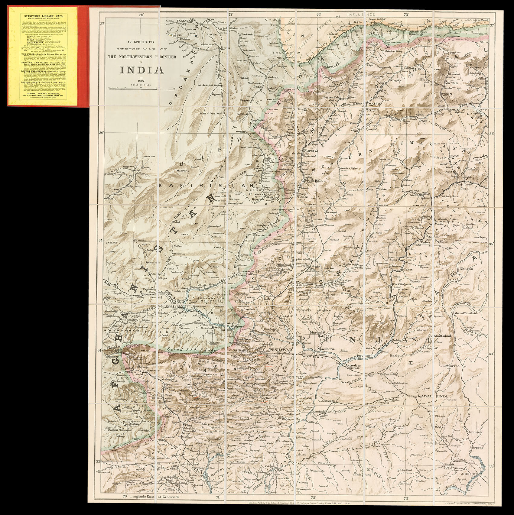
Stanford's Sketch map of the North-Western Frontier of India

STANFORD, Edward

  • Publisher: Edward Stanford,
  • Published: 1897. , London,
London,: Edward Stanford,, 1897.. Stanford's map of North West India Chromolithograph map, dissected into 30 sections and laid on linen, folding into contemporary red cloth boards with printed label to upper cover. Edward Stanford (1827-1904) was a highly successful publisher, known for his accurate maps of London. He began his career working for Trelawny Saunders, an enterprising mapmaker who supplied a daily weather chart for the Great Exhibition. Stanford started his own business in 1853, was elected a fellow of the Royal Geographical Society the following year and set about expanding the cartographical aspect of the firm. Stanford's great rival was James Wyld, and both publishers produced a geological map of the entire London area in 1870. During the late nineteenth century, public interest in India was at a high, due to fear of a Russian invasion, negotiations between the British authorities and the Amir of Afghanistan, and a series of small battles between the British and Pashtun tribes, including the Mohmand Campaign which Winston Churchill accompanied as second lieutenant and war correspondent. These events were concentrated in the North Western Frontier, which was described by Edward Stanford on two maps in the 1890s. The first of these maps was more general, and was included in his 'London Atlas' of 1894, with great attention paid to relief in particular. The present sketch map, on the other hand, covers a smaller geographical area but in greater detail. It extends from Jhelum in the south to the Wakhun Corridor and the "Russian sphere of Influence" above the Oxus to the north. It also encompasses the Pamirs and a substantial part of Afghanistan. In the lower left-hand corner can be seen Malakand, northeast of Peshawar, where a British garrison was besieged before being relieved in August 1897 by a force including the young Churchill. Relief is not shown in so much detail, but significant mountains are represented by triangles, some accompanied by their impressive height given in feet. A large number of settlements are named, mostly concentrated alongside India's many rivers. It is possible that the present sketch map of 1897 may be a revised version of one introduced two years earlier.

Offered by Daniel Crouch Rare Books LLP

Daniel Crouch Rare Books LLP

4 Bury Street
St James's
London SW1Y 6AB

Store Hours

Mon-Fri 10.00-6.00. 24 East 64th Street, New York, NY 10065.
Photo of Daniel Crouch Rare Books LLP
Daniel Crouch Rare Books is specialist dealer in antique atlases, maps, plans, sea charts and voyages dating from the fifteenth to the nineteenth centuries. Our carefully selected stock also includes a number of fine prints and globes, and a selection of cartographic reference books.Our particular passions include rare atlases, wall maps, and separately published maps and charts. We strive to acquire unusual and quirky maps that are in fine condition. We are members of the following trade associations: The Antiquarian Bookseller's Association (ABA); The British Antique Dealers' Association (BADA); Confédération Internationale des Négociantes en Oeuvres d'Art (CINOA); The International League of Antiquarian Booksellers (ILAB); The Society of London Art Dealers (SLAD); and The European Fine Art Foundation (TEFAF). Daniel and Nick are also both members of The Company of Art Scholars, Dealers, and Collectors.

Terms of Sale for Daniel Crouch Rare Books LLP

Any item may be returned if you are not happy with it providing we are notified within 7 days of your receiving it. This does not affect any statutory rights you may have under UK or EU law for returning the item outside this period. All we ask is that you return the item(s) by the same or similar method to that in which they were sent to you. Your postage costs and any payment already received will be refunded immediately on our receipt of the items in the same condition as you received them.