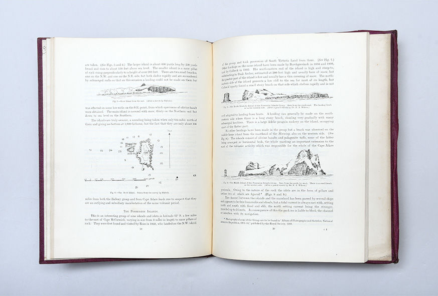
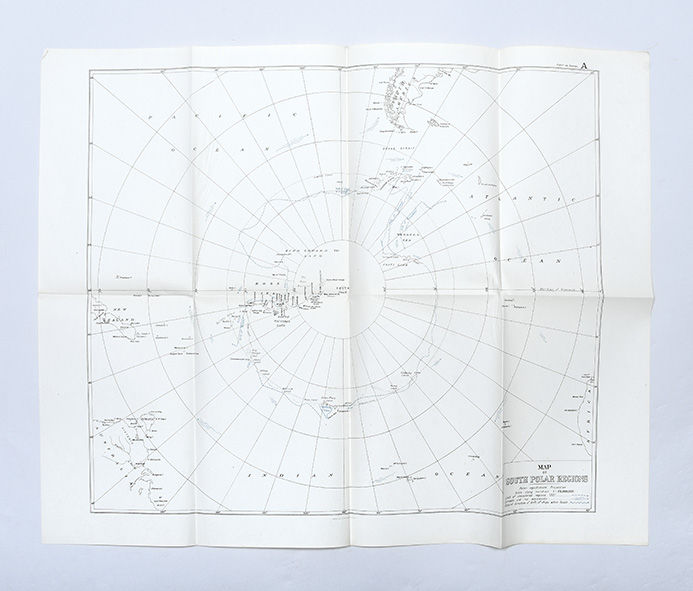
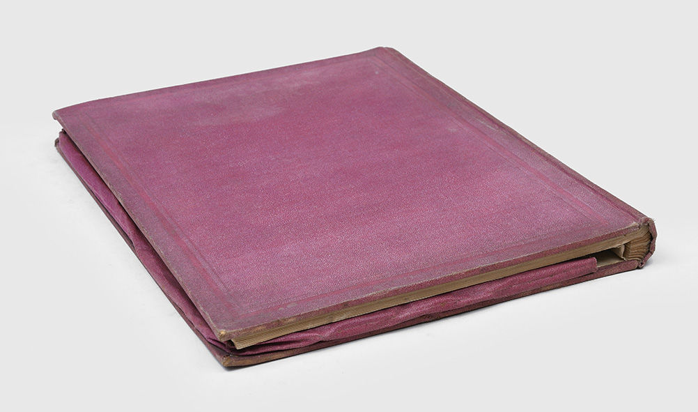
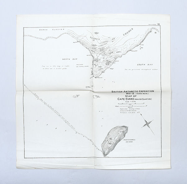
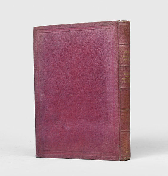
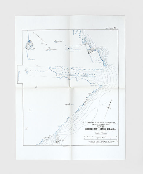
London: Harrison and Sons, Ltd,, 1923. The official cartographic record of the Terra Nova expedition First edition, first impression, written by the cartographer and geologist on Scott's second expedition. Debenham's extensive report contains 14 maps drawn for the expedition notably with the first detailed map of Erebus Bay by Ross Island (map XI). Debenham includes descriptions of the "instruments used, surveys in the vicinity of Cape Evans, an analysis of latitude measurements taken in the vicinity of the South Pole, surveys of the Balleny Islands, Possession Islands, Franklin Island, Beaufort Island, the Great Ice Barrier front and King Edward VII Land, West Coast of Ross Island, the coast of McMurdo Sound and Victoria Land" (Rosove). The Australian geologist Frank Debenham (18831965) started the geological and cartographical work on the western side of McMurdo Sound, where he visited the Koettlitz and Ferrar glacier, and the foothills of the Royal Society Range. An injury to his knee playing football in the snow prevented him from going on the ill-fated polar attempt, going instead to the Mackay Glacier and Granite Harbour. His party explored and mapped some 100 miles of coastline, extending in places up to 30 miles inland. One of his most significant contributions to the Terra Nova expedition "was his expertise in plane-table mapping. He convinced Scott and other members of the expedition of its value not only at base camps but also on sledge journeys. Scott in his diary recorded that Debenham was 'a well-trained, sturdy worker, with a quiet meaning that carries conviction; he realizes the conceptions of thoroughness and conscientiousness'" (ODNB). Debenham used a plane table from an ordinary drawing board mounted on a camera tripod. For an alidade, he used a plain wooden rule stiffened by a brass strip and the sights made of two brass hinges. On his return from Antarctica, he joined a light infantry battalion in the First World War and was severely wounded in 1916. After the war, Debenham worked on the expedition reports and became a lecturer at Cambridge. In 1920, Debenham co-founded the Scott Polar Research Institute as a part of Cambridge University. The maps comprise: General Map of the Antarctic Continent; General map of the Australian Sector of the Antarctic Continent (East Antarctica); Ross Barrier, Northern Edge (Inset Cape Crozier); Ross Island to the Pole; The McMurdo Sound Region; West Coast of Ross Island (Inset Erebus Summit); Granite Harbour Region; Ferrar-Koettlitz Region; Cape Evans and Inaccessible Island; Cape Royds District; Hut Point Peninsula; Glacier Tongue, Ross Island (Erebus Bay Ice-Tongue); Mackay Ice-Tongue, Granite Harbour; Robertson Bay; Terra Nova Bay. Quarto. With 2 half-tone plates, 15 maps in endpocket, illustrations in the text. Original maroon pebble-grain cloth, spine lettered in gilt. Rubbed with tide mark to front cover, spine and board edges sunned, scattered foxing (mostly to endpapers), small marginal hole to final blank, a few maps with slight dust soiling. A very good copy. Rosove 293-10.A1; Spence 357; Taurus 92.