Skip to content

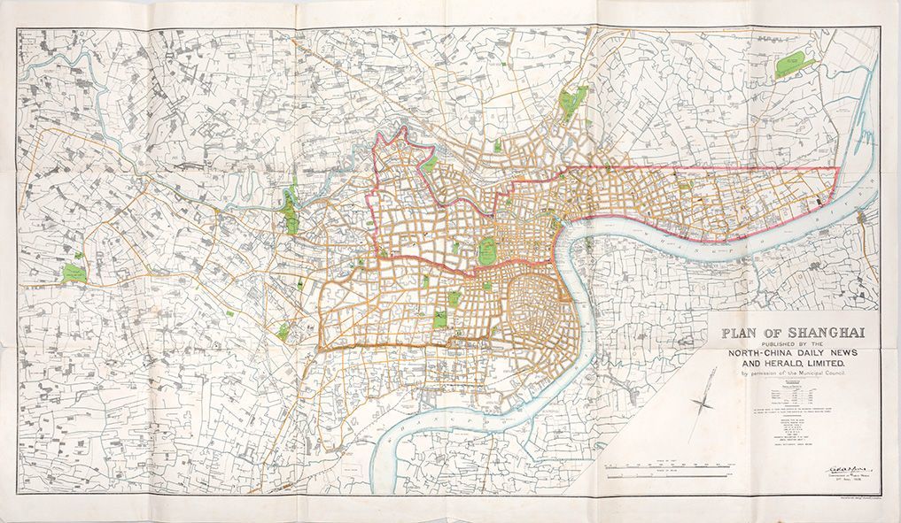
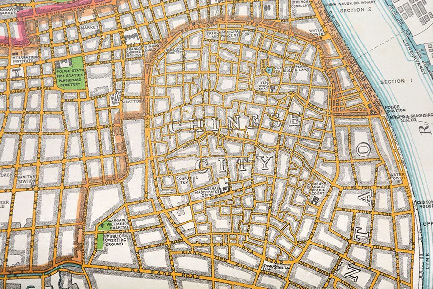
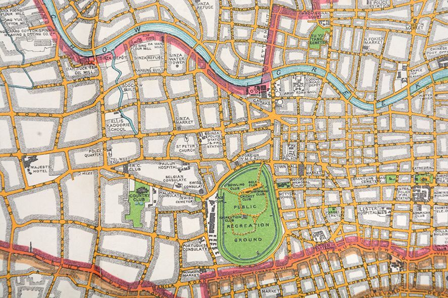
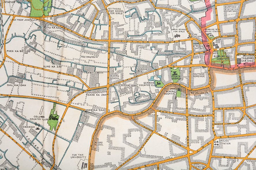
Plan of Shanghai. Published by the North-China Daily News and Herald, Limited.

SHANGHAI.

  • Published: 1928 , London: Stanford's Geographical Establishment,
London: Stanford's Geographical Establishment,, 1928. Superb map of 1920s Shanghai Rare early iteration of this important, finely detailed and impressively large map, published during a period of tremendous turmoil in the history of the city. This is an exact copy of the map issued by the Municipal Council of Shanghai (similarly dated 21 April), but with the addition of the statement of publication by the North China Daily News; both maps were issued by the famous London firm of Stanford's. The French and Shanghai International Settlements are marked by shaded borders, the area of each district given (measured in both mou and acres), and the printed note reads "the Pootung [Pudong] shore is taken from surveys by the Whangpo Conservancy Board. The French Settlement is taken from surveys by the French Municipal Council". Street and building names are shown, in profusion along the waterfront at the confluence of the Huangpu and Soochow Creek, but also into outlying rural areas beyond the urban core. Like the first edition, this map bears the printed signature of Charles Harpur, the Commissioner of Public Works who had been with the department since 1902, oversaw an extensive phase of civic construction, and would be awarded the OBE in 1929 for his service with the Shanghai Defence Force (see Isabella Jackson, Shaping Modern Shanghai: Colonialism in China's Global City, Cambridge University Press, 2018, p. 103). Shanghai had, since the 19th century, been divided up into the International Settlement, governed by Britain and the United States, whose enclaves were merged in 1863, and France. In 1927 the Nationalist Government had drawn up a plan to develop land in the north east of the city adjacent to the Huangpu River and, in an attempt to establish some form of Chinese authority, set up the Special Municipality of Shanghai. An online search of institutional libraries cites two locations only, at Leiden and the Library of Congress; no copy traced on auction records. Coloured lithographic map (1 : 15, 840) measuring 660 x 1130 mm. Presented in a handmade veneered frame with conservation acrylic glazing. One or two short splits at folds, light creasing at lower edge, creased where folded. In excellent condition.

Offered by Peter Harrington

Peter Harrington

100 Fulham Road
Chelsea
London SW3 6HS

Store Hours

Mon-Sat 10.00-6.00

Photo of Peter Harrington
Since its establishment, Peter Harrington has specialised in sourcing, selling and buying the finest quality original first editions, signed, rare and antiquarian books, fine bindings and library sets. Peter Harrington first began selling rare books from the Chelsea Antiques Market on London's King's Road. For the past twenty years the business has been run by Pom Harrington, Peter's son.

Terms of Sale for Peter Harrington

All major credit cards are accepted. Both UK pounds and US dollars (exchange rate to be agreed) accepted. Books may be returned within 14 days of receipt for any reason, please notify first of returned goods.