Skip to content

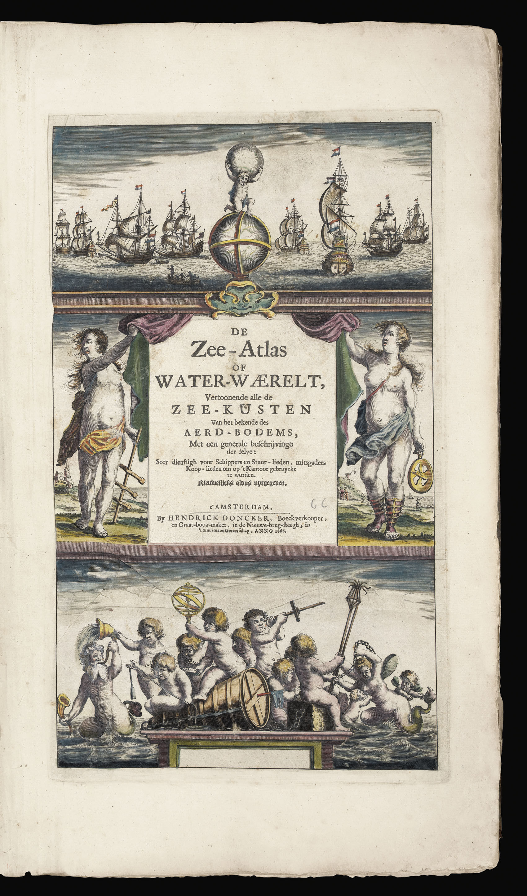
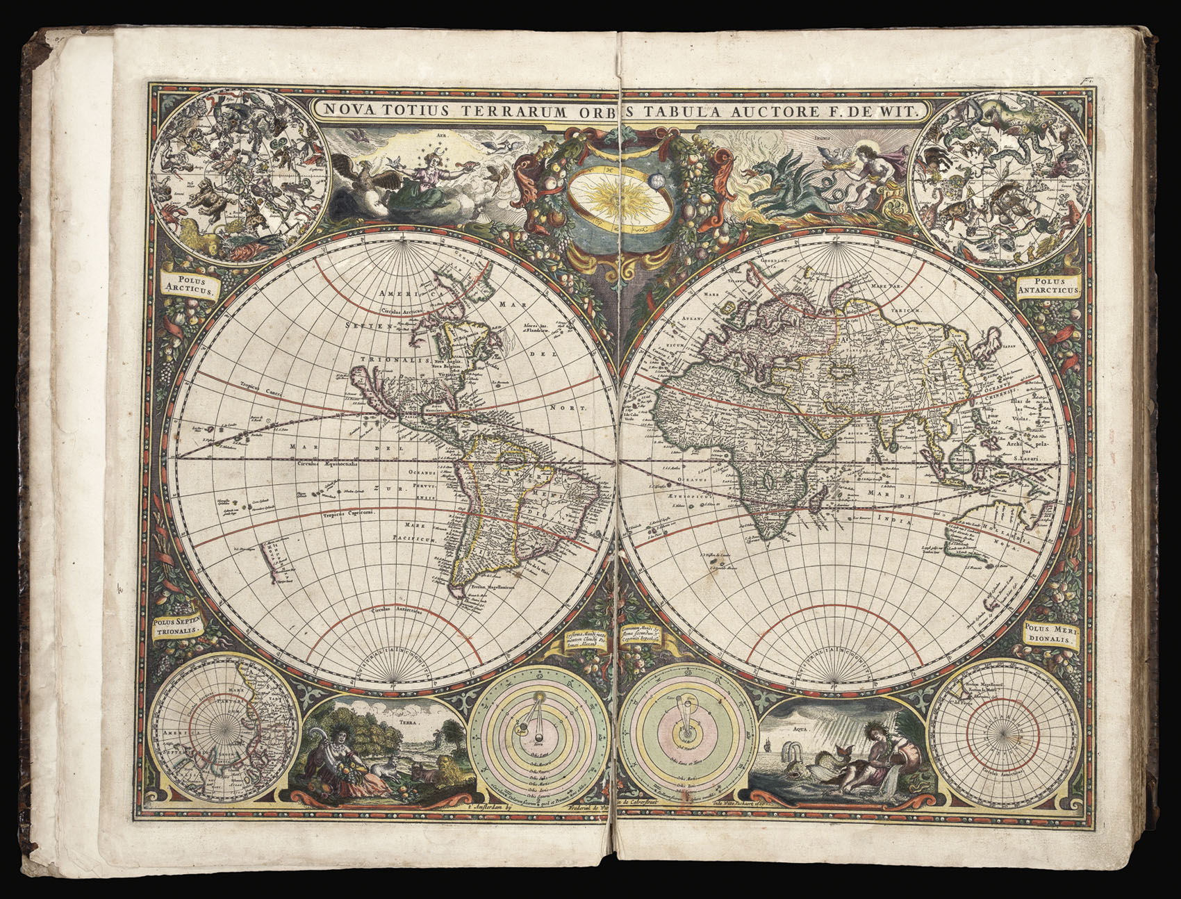
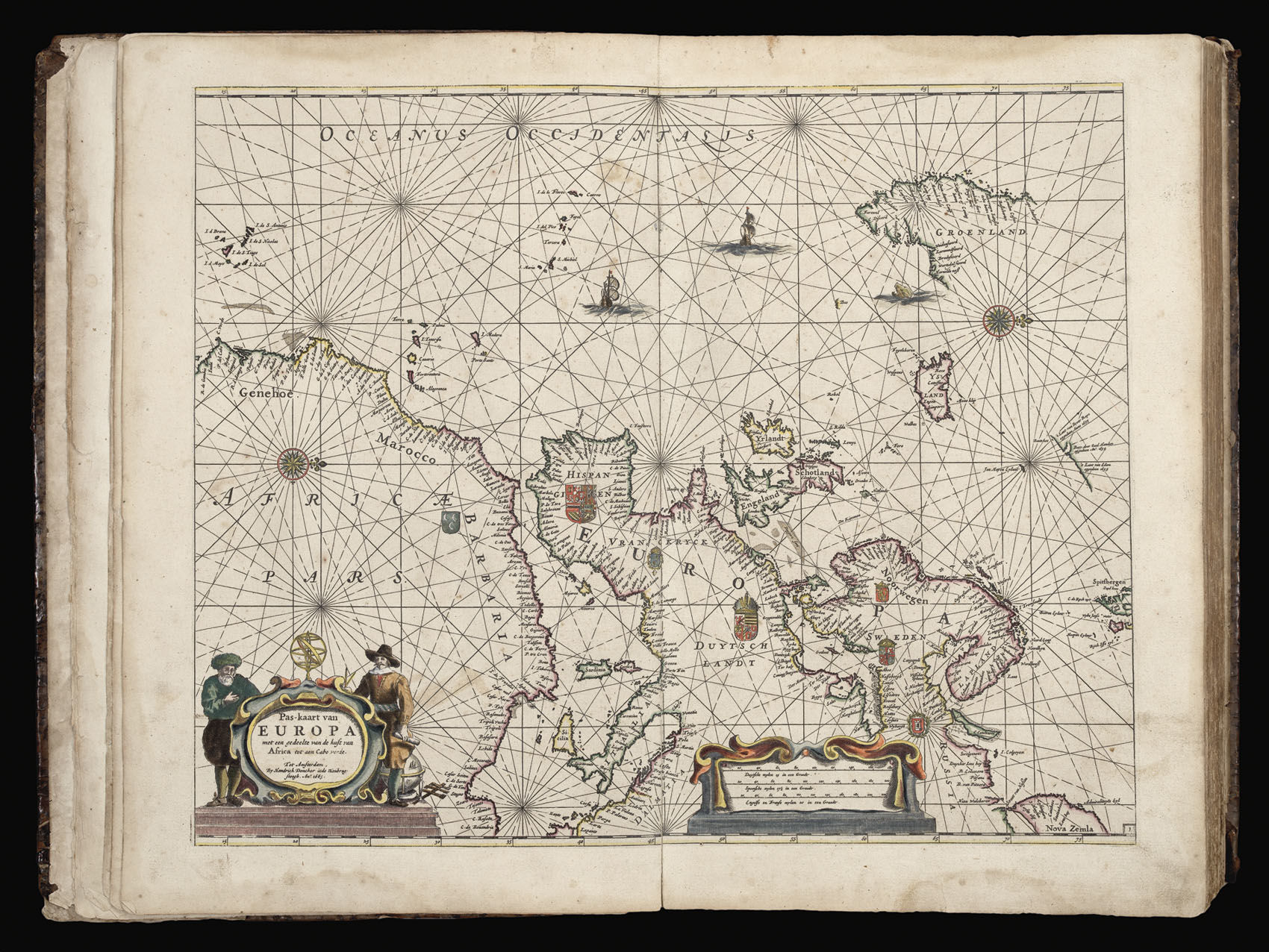
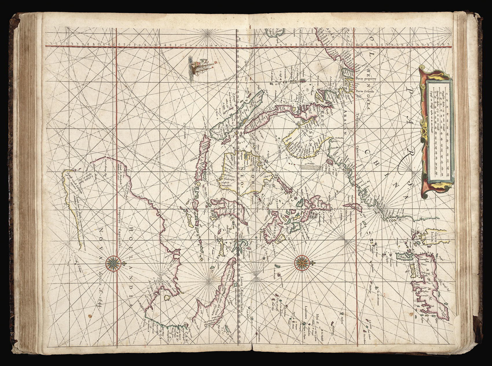
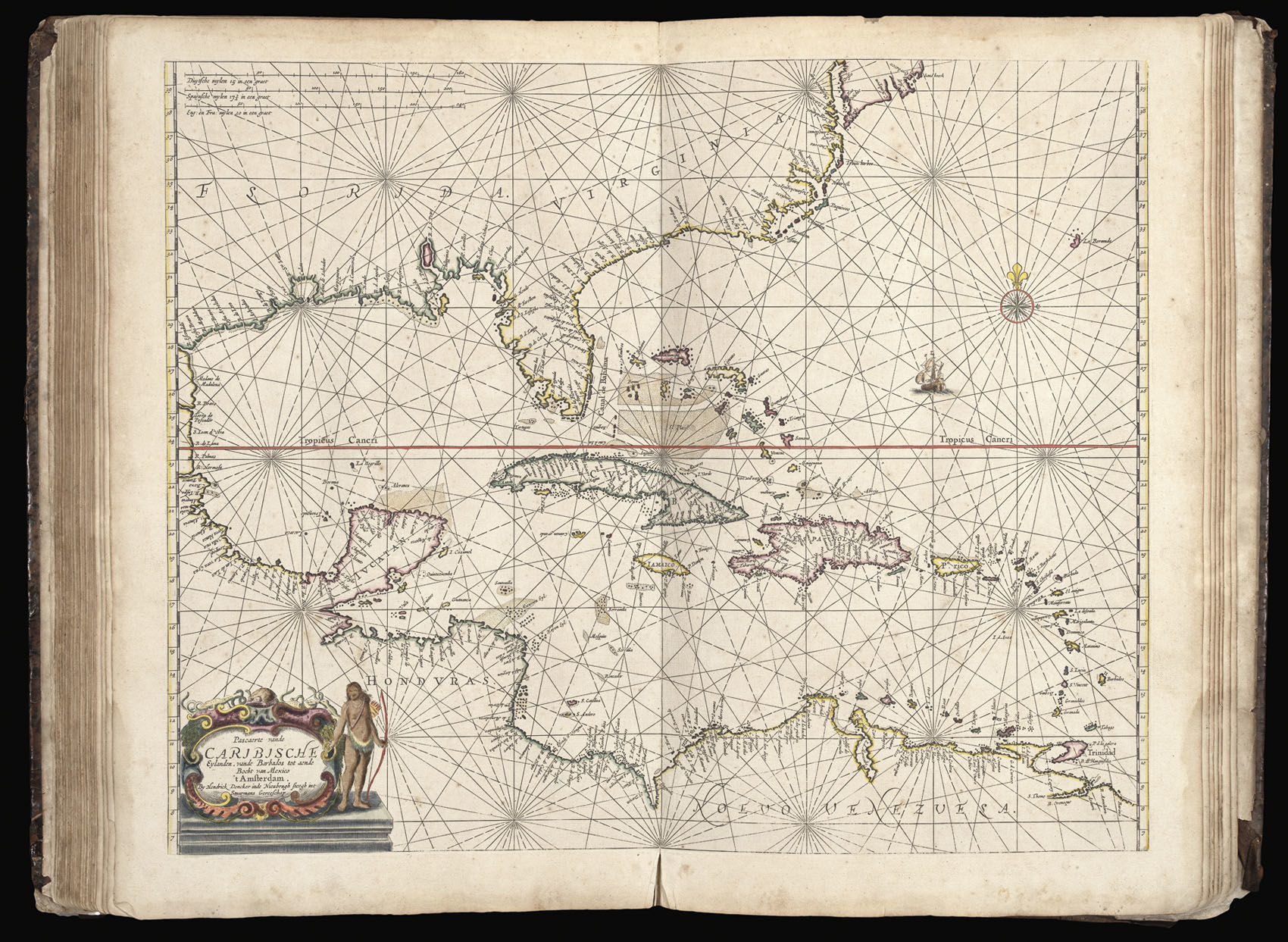
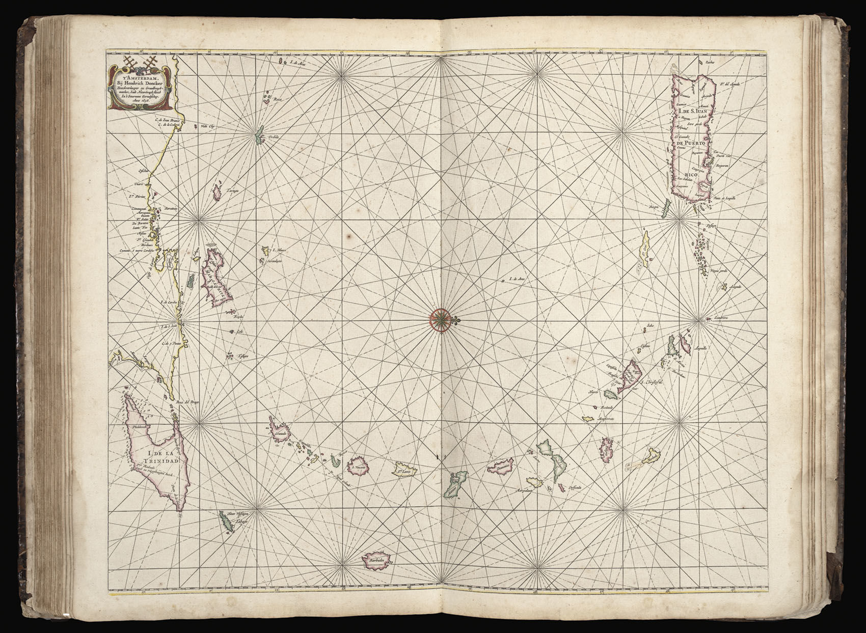
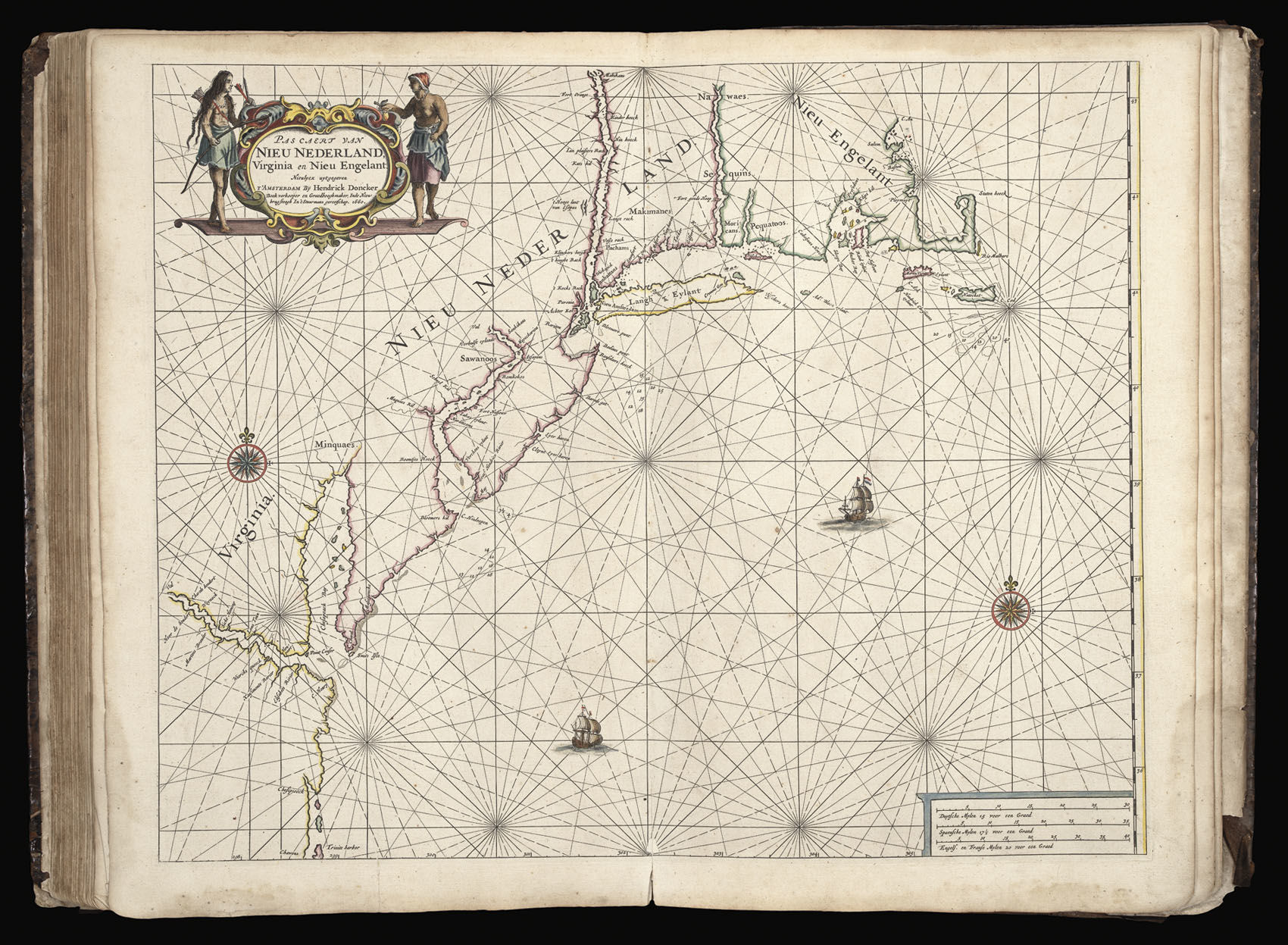
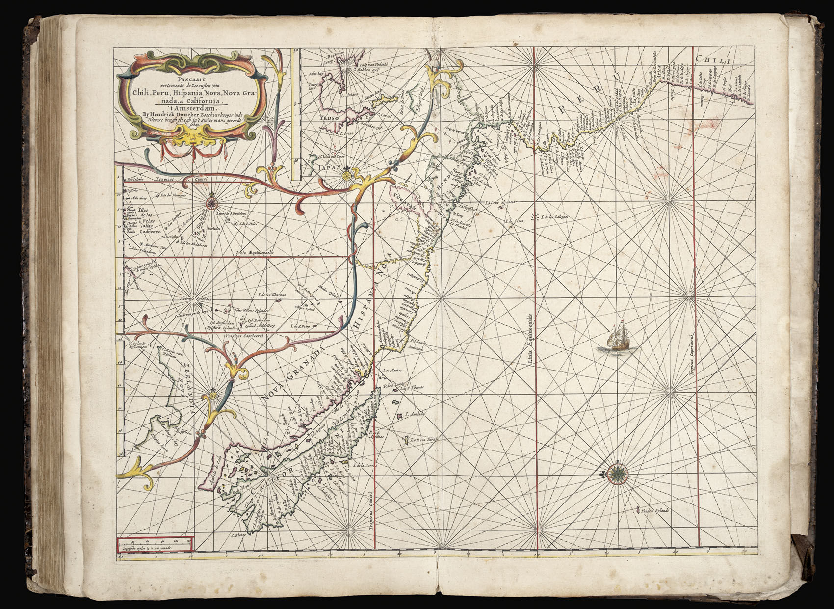
De Zee-Atlas of Water-Waerelt,

DONCKER, Hendrik

  • Publisher: Hendrik Doncker,
  • Published: 1666. , Amsterdam,
Amsterdam,: Hendrik Doncker, , 1666.. Folio atlas (500 by 320mm), title, preliminaries pages 14-22 text (complete), 34 double-page engraved charts, on laminated paper, fine original outline hand-colour, a list of previous owners of the atlas in manuscript to the upper paste-down, title-page margins skilfully repaired, some minor damp staining to margins, contemporary full calf, gilt fillet border, spine separated by raised bands, gilt. Although not the first to publish a sea atlas in Amsterdam – that honour went to Janssonius – the first edition of the 'Zee-Atlas' was published in 1659, and only one example of that edition is known, in the National Libary of Australia. Between then and 1669 the number of maps was extended from nineteen to fifty. In 1676 Doncker introduced the larger format 'De nieuwe groote vermeerderde Zeeatlas'. The atlas was re-issued until as late as the early 1700s when it was published by Doncker's son, also Hendrick, who continued the business following his father's death in 1699. Koeman notes: "Doncker's charts were the most up-to-date in the second half of the seventeenth century. Although there is some similarity to those charts published by Van Loon, Goos, Lootsman, and Doncker, the latter's charts are original. More frequently than ... [his] contemporaries, Hendrik Doncker corrected and improved his charts. He often replaced obsolete charts by new ones ... This consciousness of the high demands of correctness is reflected by the development of Doncker's sea atlas". The charts of the Americas include the "Pas caert van Nieu Nederland, Virginia en Nieu Engelant" - the third printed chart of the New Netherlands, and the 'Pascaart vertoonen de Zeecusten van Chili, Peru, Hispania Nova, Nova Grenada en California - orientated with east at the top and depicting California as an island on a larger scale than any earlier sea chart.. The the preliminaries and charts conform to Koeman Don 9B, but contain the additional charts of 'De cust van Zeelandt...', and 'De Cust Vlaenderen...', which Koeman records as first appearing in the Spanish edition of 1669. c.f. Koeman, Don 9B; and Don 13.

Offered by Daniel Crouch Rare Books LLP

Daniel Crouch Rare Books LLP

4 Bury Street
St James's
London SW1Y 6AB

Store Hours

Mon-Fri 10.00-6.00. 24 East 64th Street, New York, NY 10065.
Photo of Daniel Crouch Rare Books LLP
Daniel Crouch Rare Books is specialist dealer in antique atlases, maps, plans, sea charts and voyages dating from the fifteenth to the nineteenth centuries. Our carefully selected stock also includes a number of fine prints and globes, and a selection of cartographic reference books.Our particular passions include rare atlases, wall maps, and separately published maps and charts. We strive to acquire unusual and quirky maps that are in fine condition. We are members of the following trade associations: The Antiquarian Bookseller's Association (ABA); The British Antique Dealers' Association (BADA); Confédération Internationale des Négociantes en Oeuvres d'Art (CINOA); The International League of Antiquarian Booksellers (ILAB); The Society of London Art Dealers (SLAD); and The European Fine Art Foundation (TEFAF). Daniel and Nick are also both members of The Company of Art Scholars, Dealers, and Collectors.

Terms of Sale for Daniel Crouch Rare Books LLP

Any item may be returned if you are not happy with it providing we are notified within 7 days of your receiving it. This does not affect any statutory rights you may have under UK or EU law for returning the item outside this period. All we ask is that you return the item(s) by the same or similar method to that in which they were sent to you. Your postage costs and any payment already received will be refunded immediately on our receipt of the items in the same condition as you received them.